Amy Sprague
November 22, 2023
UW researchers are developing a drone-based salmon survey method that the Sauk-Suiattle can use to manage resources.
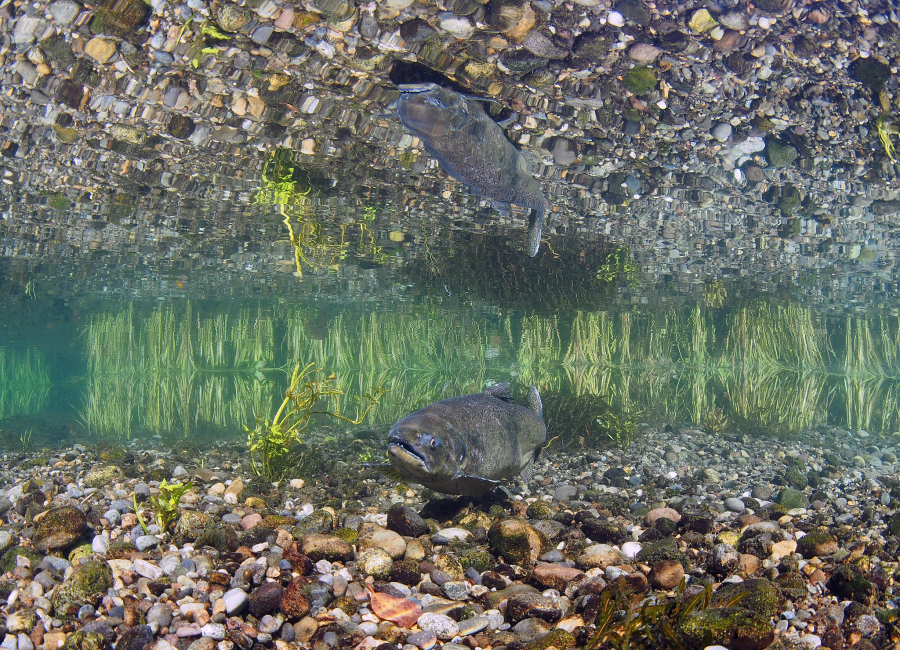
Video footage of a salmon in the Snoqualmie River during a CTRL practice drone flight. Credit to CTRL’s Helen Kuni and Evelyn Madewell.
Climate change is not only negatively affecting Chinook salmon populations, but it’s also making it harder to monitor those affects. UW assistant professors Andrew Berdahl and Karen Leung are working on a solution, with an EarthLab Innovation Grant, that will not only make monitoring more easy and accurate, but will also give the Sauk-Suiattle Indian Tribe more power to manage their salmon stock.
Surveying Chinook salmon just got even harder

A female Chinook salmon stands guard on her redd at McAllister Springs in Lacey, Washington. © to USFWS – Pacific Region (credit to Roger Tabor), used under Attribution-NonCommercial 2.0 Generic.
The Sauk-Suiattle harvest Chinook salmon in the Skagit River system for commercial, subsistence, and ceremonial benefits through treaty-protected fisheries. Management of the fishery, with the State of Washington, includes setting harvest guidelines and recovery planning. But a successful management system depends on an accurate survey of Chinook numbers in the ecosystem.
The Tribe has partnered with the Washington Department of Fish and Wildlife to conduct helicopter surveys of the gravel nests that female Chinook salmon build to lay their eggs, or redds, to estimate population numbers. Not only are helicopter surveys expensive, but they are becoming less feasible with the effects of climate change on the river systems.
Increasing temperatures are altering river runoff, creating more silt in the water and obscuring the view of the Chinook redds. While there are times when the water is clearer, it is hard to predict, and helicopters need to be booked months in advance. Researchers need a more responsive, cost-efficient and nimble method to conduct these surveys,

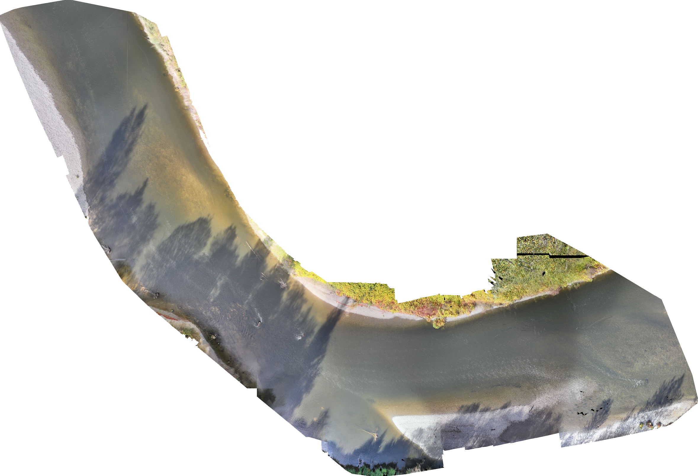
An orthomosaic image of a segment of the Snoqualmie River. An orthomosaics is a detailed collage of smaller images stitched together using software. This orthomosaic was created using Pix4dmapp. Credit to CTRL’s Helen Kuni and Evelyn Madewell.
An interdisciplinary UW effort will deliver advantages

Andrew Berdahl
Berdahl from the School of Aquatic and Fishery Sciences (SAFS) and Leung from the aeronautics and astronautics (A&A) department, with A&A staff engineer Helen Kuni, and SAFS postdoc Benjamin Kroger (now faculty at the University of Wyoming), are partnering with the Sauk-Suiattle’s Fish Program Manager Grant Kirby through a UW EarthLab Innovation Grant to develop a safe, cost-effective, and accurate system based on drones and AI-based computer vision to monitor numbers of spawning Chinook salmon in the Skagit River and its tributaries.
There are advantages to using drones and computer vision techniques to collect the data on salmon and their nests. Getting this system right will increase accuracy while delivering tremendous savings.
Leung explains, “Researchers won’t be booking an expensive helicopter in advance for what turns out to be a low-visibility day. We can fly drones opportunistically based on daily river conditions. Also, because of the lower cost and convenience, we can survey more frequently throughout the season for higher precision monitoring.”

Karen Leung
Using drones has the added benefit of giving the Sauk-Suiattle the ability to collect their own data to best co-manage their salmon fishery. “Additionally,” Berdahl says, “beyond giving just raw counts, as the helicopter surveys do, the drone surveys give the location of each redd. These data will allow us to quantify how the Chinook make fine-scale habitat-use decisions about where to spawn as river conditions change across years.”
The challenges of setting up a drone-based Chinook survey
The research team has several steps with logistics, protocols, and training a neural network model to identify Chinook salmon and their redds. First, they need to establish the flight operations which need to be safe, efficient, and repeatable while capturing usable images and covering the entire target region. This will include interpreting conditions such as the position of the sun and general brightness and positioning the drone for reduced glare.
A&A researchers from Leung’s Control and Trustworthy Robotics Lab (CTRL) will be developing ways to automate a lot of the processes and investigate ways where autonomy could be used to streamline the operations. Flying a drone taking imagery along a winding river with varying landscapes is challenging. The drone must remain in line of sight of its pilot, so the pilot needs to travel along the river in a boat. A&A research can improve the drone piloting process.
Researchers will also develop computer vision techniques to identify the salmon and redd. Working with Tribal biologists, they will manually review sets of drone images to identify salmon and redds to develop and train a neural network model to automatically highlight likely redds in all survey images. Biologists will then verify flagged images.
This human-in-the-loop process allows managers to generate efficient and reliable redd counts into the future. And the system will get more efficient over time. Many ever-changing daily and seasonal conditions are outside of the training set, but with continued training of the neural network, the system will account for these conditions.
This approach, part of an emerging field, does not try to replace human expertise, but instead trains models to more efficiently leverage human expertise across a wider range of images so that humans only have to solve the hardest out of domain examples which can then be used to further improve the model further.
UW EarthLab awarded this project $75,000 as a viable project to develop actionable research at the intersection of climate change and social justice, making a positive impact on people’s lives and livelihoods.